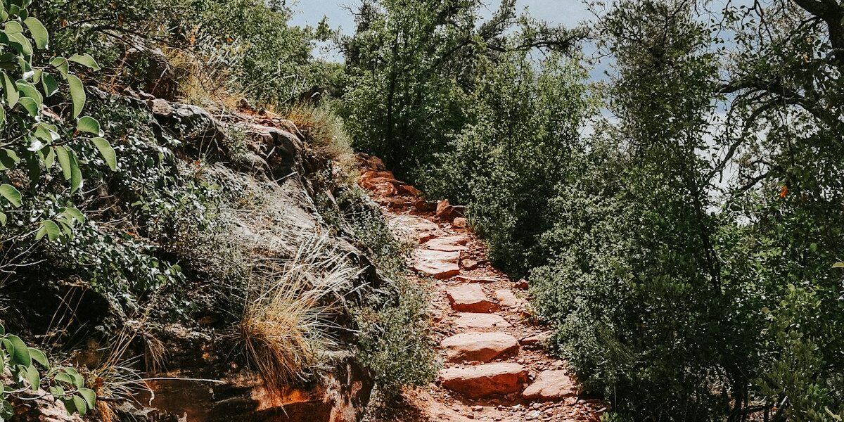
The best summer hiking trails are not simply the routes with the biggest views. When heat rises, a good choice combines a manageable distance with shade, elevation, an early start, a reliable turnaround point, and current access information. Forest and lakeside routes can feel cooler, while high-elevation loops may offer lower air temperatures—but altitude, storms, snow, and exposed terrain create their own risks.
This guide highlights four U.S. summer trail ideas with different difficulty levels, then shows how to evaluate any local route. Conditions, parking, permits, fire closures, water availability, and weather can change quickly. Always check the land manager’s current alerts immediately before leaving.
Four summer trail ideas at a glance
| Trail | Summer advantage | Distance | Main caution |
|---|---|---|---|
| Hall of Mosses or Spruce Nature Trail, Olympic National Park | Short forest loops with abundant canopy | 0.8 or 1.2 miles | Popular access area; wet surfaces and changing road conditions |
| Jordan Pond Path, Acadia National Park | Forested shoreline setting | 3.3-mile loop | Western side has rocks, boardwalks, and uneven footing |
| Alum Cave Bluffs, Great Smoky Mountains National Park | Forest, streams, elevation gain, and a shaded rock overhang | About 4.6 miles round trip | Strenuous sections and limited parking at a popular trailhead |
| Naches Peak Loop, Mount Rainier National Park | Subalpine elevation, lakes, and mountain views | 3.5-mile loop | Exposure, altitude, lingering snow, storms, and no pets on the park section |
“Cooler” is relative. A shaded trail can still become dangerous during an excessive-heat event, and a mountain route can be sunny, dry, and strenuous. Check the forecast for the trail’s actual elevation and location—not merely the nearest city.
1. Hall of Mosses and Spruce Nature Trail, Washington
Olympic National Park’s Hoh Rain Forest offers two short loops near the visitor area. The Hall of Mosses Trail is listed by the park at 0.8 mile, while the Spruce Nature Trail is a 1.2-mile loop through old- and new-growth forest beside Taft Creek and the Hoh River. These routes make sense when the goal is a short forest walk rather than a strenuous mileage challenge.
The canopy and short distance can reduce sun exposure, but the rainforest is not hazard-free. Roots, mud, wet wood, and slick surfaces demand attention. The Hoh area is popular, so congestion and parking can shape the day as much as trail difficulty. Review Olympic National Park’s current Hoh Rain Forest visitor information for access, facilities, and trail descriptions.
Choose Hall of Mosses for the shortest iconic loop. Choose Spruce Nature Trail for a slightly longer walk that includes river and creek environments. The Hoh River Trail continues much farther, but an out-and-back should have a predetermined turnaround time; do not let an easy forest start quietly become an unplanned backcountry day.
2. Jordan Pond Path, Maine
Jordan Pond Path circles one of Acadia National Park’s best-known landscapes. The National Park Service describes it as a 3.3-mile loop with forested sections, shoreline views, boardwalks, rocks, and footbridges. The eastern side begins on comparatively even crushed-stone terrain, while the western side is notably more difficult and includes uneven rocks and narrow boardwalks.
That difference makes the route adaptable. A party uncertain about completing the loop can begin on the eastern side and turn around before committing to the rougher western half. Water views do not make this a swimming trail: Jordan Pond is a public water supply, and wading and swimming are prohibited.
Read the official Jordan Pond Path description for current details. Parking can be heavily used, and Acadia’s seasonal Island Explorer may provide another way to reach the area when operating. Verify the current transit schedule rather than assuming a past route or time still applies.
3. Alum Cave Bluffs, Tennessee
Alum Cave Trail in Great Smoky Mountains National Park climbs through forest and along mountain streams to a large rock overhang. The park describes the hike to Alum Cave Bluffs as about 4.6 miles round trip. The destination is not a true cave, but the overhang provides a distinctive turnaround point and shelter from direct sun or rain.
This is not an easy lakeside stroll. Elevation gain, rocks, roots, wet surfaces, and summer humidity increase effort. Start early, turn around when the group’s pace or weather requires it, and never treat the shade at the destination as a substitute for heat planning. The trail continues toward Mount Le Conte, but that longer objective requires substantially more time, fitness, and preparation.
Consult the park’s current Alum Cave Bluffs information. The National Park Service specifically recommends arriving early because parking is limited at this popular trailhead and notes that a shuttle may be worth considering.
4. Naches Peak Loop, Washington
Naches Peak Loop near Chinook Pass is a different way to reduce summer heat exposure: gain elevation rather than staying under dense canopy. Mount Rainier National Park lists the loop at 3.5 miles with about 500 feet of elevation gain and an estimated two-hour hiking time. The route crosses subalpine meadows, passes mountain lakes, and shares a section with the Pacific Crest Trail.
High elevation does not guarantee easy conditions. Snow can linger into summer, sun can be intense, weather can shift quickly, and altitude adds strain for people arriving from lower elevations. Stay on the trail to protect fragile meadows, treat any collected water, and verify current trail and road conditions.
The official Naches Peak Loop guide recommends hiking clockwise for Mount Rainier views. It also explains that pets are not allowed on the portion inside the national park, though rules differ on the Pacific Crest Trail section outside the boundary.
How to find a cooler summer hike near you
Use a map and official trail information to look for these characteristics:
- Continuous canopy: Forest shade reduces direct solar exposure, though humidity can remain high.
- North-facing slopes: They often receive less direct sun than exposed south-facing slopes.
- Higher elevation: Air may be cooler, but altitude, lightning, UV exposure, wind, and snow must enter the decision.
- Short loops or out-and-backs: A clear turnaround point limits time in worsening heat.
- Early access: A trailhead available around sunrise lets you finish before peak afternoon heat.
- Reliable bailout options: Intersections, shuttle stops, or shorter loop variants give the group alternatives.
- Known water plan: Confirm what must be carried and whether natural sources are currently flowing and treatable.
A waterfall, river, or lake on a map is not automatically drinking water, a legal swimming area, or a safe cooling point. Swift current, cold water, slippery rock, contamination, seasonal drying, and closures all matter. The National Park Service warns hikers to avoid rapid water and slippery slopes and not to cross when depth or conditions are uncertain.
A summer route-selection scorecard
Before choosing between trails, rate each option from one to five in these categories:
| Factor | Safer summer signal | Reason to downgrade |
|---|---|---|
| Heat exposure | Shade, early access, moderate forecast | Long exposed slopes or excessive-heat alert |
| Effort | Distance and climb below your normal limit | New altitude, heavy pack, or ambitious pace |
| Water | Enough carried plus verified backup | Unconfirmed source or no treatment method |
| Navigation | Signed route, offline map, obvious turnaround | Faint junctions or dependence on cell service |
| Escape options | Short loop, shuttle, or easy turnaround | Commitment terrain with no early exit |
| Current status | Recent official update and open access | Fire, storm, road, bridge, or permit uncertainty |
Reject a route when one critical factor is unacceptable; do not let attractive scenery average away a severe heat warning, closure, missing water, or inability mismatch. Keep a shorter Plan B in the same area.
Plan the timing, not just the mileage
Start early enough to complete exposed sections before the hottest part of the day. Work backward from a firm turnaround or finish time, then include driving, parking, bathroom stops, and slower group members. Afternoon thunderstorms are common in many mountain and monsoon regions, so “cooler later” may not mean safer.
The National Park Service’s Hike Smart guidance recommends matching a route to the whole group, leaving a trip plan, checking weather and park alerts, carrying the essentials, having a backup plan, and accounting for altitude. It also notes that heat illness and dehydration can develop during a hike.
Turn around for rising heat, unexpected fatigue, dwindling water, thunder, smoke, lost time, or a group member who is not recovering during breaks. Reaching a viewpoint is optional; returning safely is not.
What to carry on a hot-weather hike
- Enough water for the route, conditions, and individual needs, plus a realistic reserve
- Food and salty snacks appropriate for the length and exertion
- Sun-protective clothing, hat, sunglasses, and sunscreen
- Offline map and a navigation method you know how to use
- Insulating and rain layers even when the trailhead is warm
- Headlamp, first aid, whistle, emergency shelter, and repair basics
- Water treatment when the plan legitimately includes natural sources
- Any medication and personal emergency information
There is no universal water quantity that fits every hiker and climate. Body size, pace, humidity, altitude, sun, route length, and medical factors change needs. Check local guidance, begin hydrated, drink according to thirst and conditions, and avoid both dehydration and forced overconsumption.
Recognize heat trouble
Heat exhaustion can involve heavy sweating, weakness, dizziness, headache, nausea, or faintness. Stop exertion, move to a cooler place, loosen excess clothing, and cool the person. Confusion, collapse, altered behavior, or very high body temperature can indicate heat stroke, which is an emergency. Call emergency services and begin rapid cooling while help is arranged.
Do not assume cell coverage. Tell someone the exact route, trailhead, participants, vehicle, and expected return time. Know how the managing agency handles emergencies and what landmarks or coordinates you could provide.
Frequently asked questions
Are forest trails always cooler?
They reduce direct sun, but humid air, limited wind, steep climbing, and heat alerts can still make them dangerous. Evaluate forecast, effort, water, and escape options together.
Is a high-elevation trail best in summer?
Sometimes, but it adds altitude, UV exposure, rapidly changing weather, lightning, wind, and possible snow. Acclimate when needed and check conditions at trail elevation.
What time should a summer hike begin?
Early enough to finish exposed or strenuous sections before expected peak heat and storms. The exact time depends on local sunrise, forecast, trail access, pace, and land-manager guidance.
Can I rely on streams for drinking water?
Only when an official or recent local source confirms water is available and your plan includes suitable treatment. Seasonal sources can dry up, and clear water can still contain pathogens.
Should I cancel during an excessive-heat warning?
Choose a safer activity or time when official warnings, local agencies, or the group’s abilities indicate the route is inappropriate. A shaded trail does not cancel extreme environmental risk.
Bottom line
A strong summer trail choice combines shade or elevation, conservative effort, early timing, verified access, enough water, and a simple exit plan. Hall of Mosses, Spruce Nature Trail, Jordan Pond Path, Alum Cave Bluffs, and Naches Peak Loop illustrate different ways to build a cooler day—but every one still requires a current conditions check. Pick the route that fits the weather and the least-experienced person in the group, and keep an easier Plan B ready.


Stay in the loop
Get the latest trail rise updates delivered to your inbox.